Necessary freeware in order to view charts:
| Viewer Software | SeeMyENC v2.2.0 |
In the SeeMyENC freeware viewer, you may load the 000 files as usual. Then select “Load Chart Update(s)...” from the "Load" menu in order to load the update file as well. For charts in the Inland ECDIS 2.3 format, please choose the corresponding format in the menu bar.

For commercial viewers, please use the respective instruction manual.
To unpack this file you need the open source program 7-zip, for example. You can download this programme at www.7-zip.de.
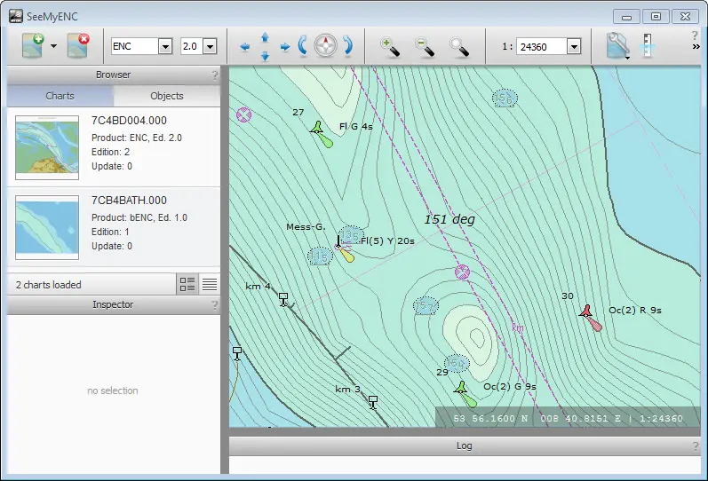
Viewing Bathymetric Inland ENCs (bIENCs) in SeeMyENC
Bathymetric data contained in Inland ENCs is normally abstracted and summarised for general navigation. Where more detailed information is needed, SevenCs ENC Tools can be used to create so-called bathymetric inland ENCs (bIENCs) from most common formats of digital bathymetry. The result is an S-57 data product that can be either displayed on its own or in conjunction with a normal inland ENC. Typical applications include dredging and piloting.
Inland ENC standard 2.4 introduced the concept of separate bathymetric layers as bIENCs. They can be loaded in SeeMyENC as well.
A sample bIENC is included with SeeMyENC in the /data/examples/ directory.